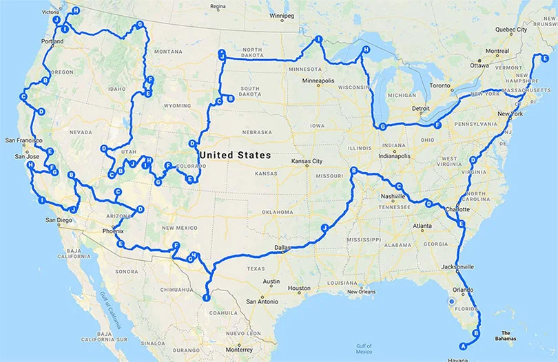
Can you imagine visiting 50 National Parks in one trip? We used Google Maps
to create the digital road map just for this incredible adventure. The
journey starts in Key West, Florida at Dry Tortuga National Park, and heads
north up the east coast, hitting three parks along the way to Acadia
National Park on the Atlantic Ocean in Maine. Next leg of the journey
travels west across the upper Mid-Atlantic states stopping at one of the
United States newest properties, Indiana Dunes National Park before making a
right turn and heading north to the border of Canada for two stops - Isle
Royale and Voyageurs National Parks. The next leg of the journey stops at
some of the most popular parks in the country with Zion, Bryce, Arches,
Yellowstone, Theodore Roosevelt, Rocky Mountains and more before heading
towards the Pacific Coast. The West Coast has some spectacular features like
the deepest lake in the country at Crater Lake, the highest peak in the
lower 48 in Mt. Whitney at Sequoia, Half Dome at Yosemite, and the Giant
redwoods of Redwood National Park. Continuing on the next leg of the trip
out to the desert southwest of Arizona to one of America's most
popular National Parks - The Grand Canyon. The 2 week marker of this journey
is down near the US-Mexico border at Big Bend National Park, followed by Hot
Springs in Arkansas, and up in St. Louis to the Gateway Arch. Finally, the
journey takes us underground in Mammoth Cave, Kentucky where the 3 week
finish line is in America's most visited park - the Great Smokey
Mountains.


